

Meteorologist April Loveland's First Warning Forecast
Tuesday continues the sunny streak with highs in the low 80s. With no rain in the forecast, it’s another excellent day to be outdoors.
It'll be mostly sunny Wednesday with highs in the low 80s. Expect a few clouds to dot the sky, but they won’t interfere with your plans.
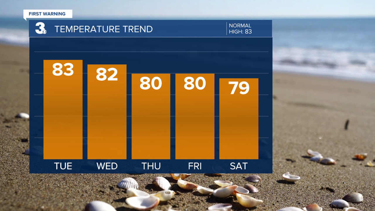
Thursday brings partly cloudy skies and highs in the low 80s. Rain chances will be slim, so it'll be another fantastic day for outdoor activities.
Friday wraps up the week with highs falling back into the upper 70s to near 80. Expect more clouds than sunshine. Keeping a slight chance for a few spotty showers.
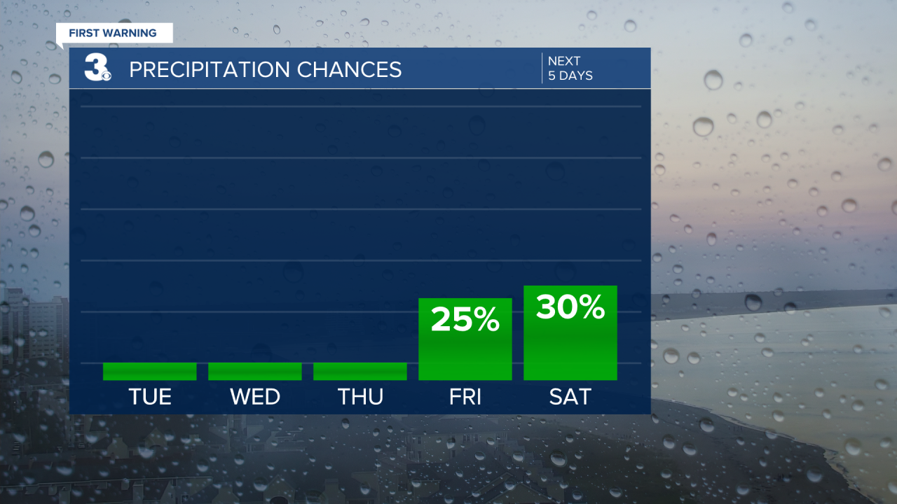
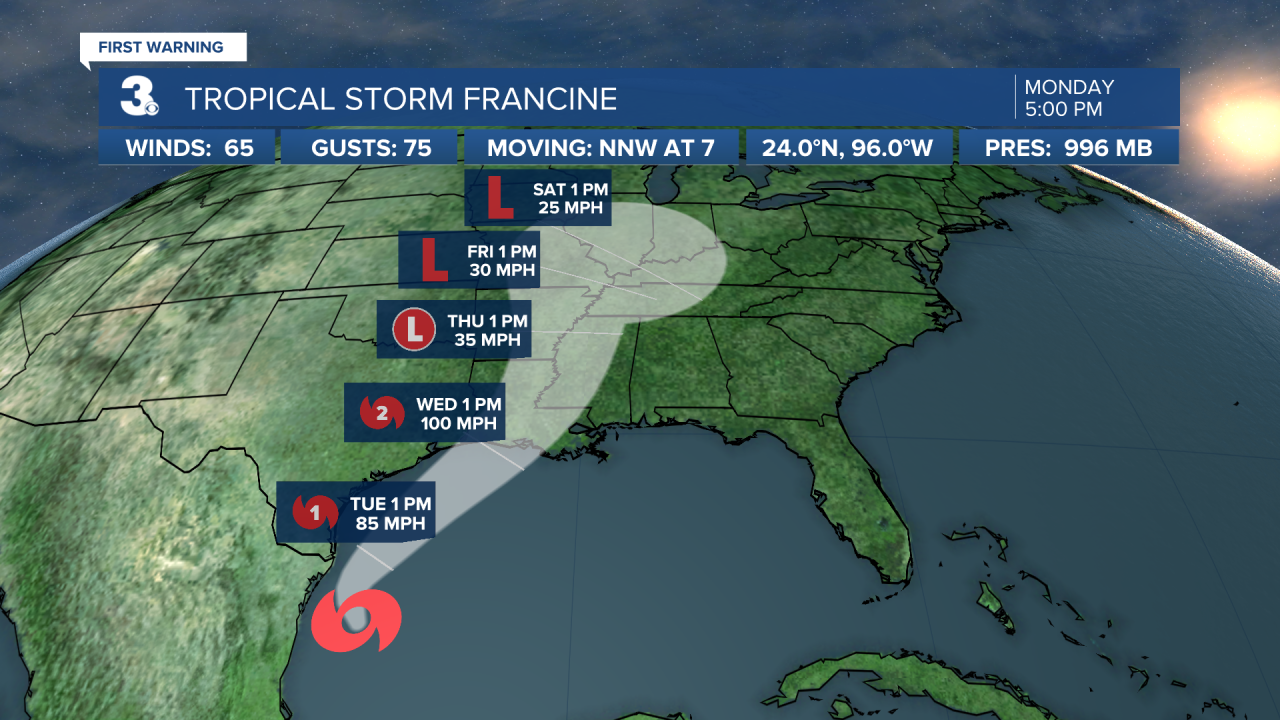
The weekend is looking a bit unsettled, but not a complete washout. We could potentially see a bit of moisture from Tropical Storm Francine, but there is still a lot of uncertainty and it's not looking like much. As of now, keeping a chance for some scattered showers on Saturday and a few spotty showers on Sunday. High temperatures will warm to the upper 70s and low 80s.
Tropical Update:

Meteorologist April Loveland
For weather updates on Facebook: HERE
Follow me on Twitter: HERE
Follow me on Instagram HERE
Check out the Interactive Radar on WTKR.com: Interactive Radar
