

Meteorologist April Loveland's First Warning Forecast
FLOOD WATCH in effect from Wednesday Evening through Friday Evening—flooding from excessive rainfall will be possible.

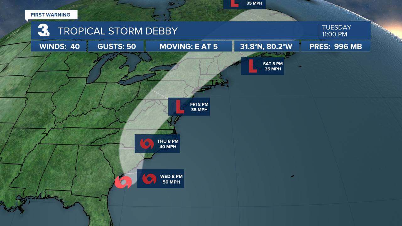
Showers will be possible overnight. Heavy downpours will be possible by Wednesday morning. We're expecting pockets of heavy downpours throughout the day as Debby inches closer.
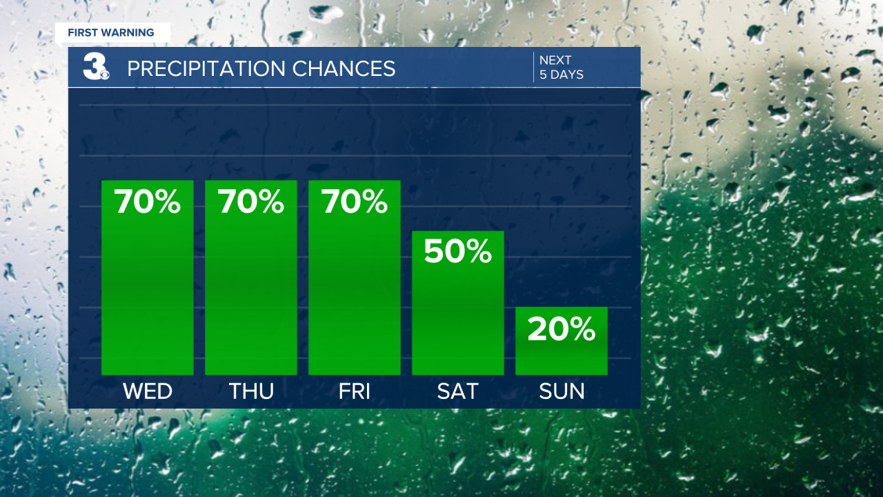
Rain and storms at times on Thursday. The entire area is under a Level 1 for severe storms. The biggest threats will be damaging wind gusts, flooding rainfall and tornadoes. Our tornado threat will go up Thursday evening.


The wind will pick up throughout the day out of the southeast at 10-20 mph and gusts up to 30 mph. Periods of rain and storms continue into the day Friday. It will still be windy with winds out of the southeast at 15-25 mph and gusts up to 35 mph. Coastal flooding and dangerous rip currents will also be possible.
Debby should start to pull away on Saturday. Keeping a chance for wet weather in the morning with drier air moving in by the afternoon. We should be able to salvage some of Saturday. Sunday is looking much better with clearing skies and highs in the low 80s. Expect highs in the 80s from Wednesday through Saturday. Even though temperatures will be sitting below normal, the humidity will be on the high side.
More comfortable air will move in by Sunday. Expect dry weather Monday and Tuesday.
Stay tuned for any updates!
Tropical Update:
Meteorologist April Loveland
For weather updates on Facebook: HERE
Follow me on Twitter: HERE
Follow me on Instagram HERE
Check out the Interactive Radar on WTKR.com: Interactive Radar
