


Meteorologist Kristy Steward's First Warning Forecast
Happy Thursday evening! We were hotter today, but the hottest air has yet to arrive. Relief is in sight though.

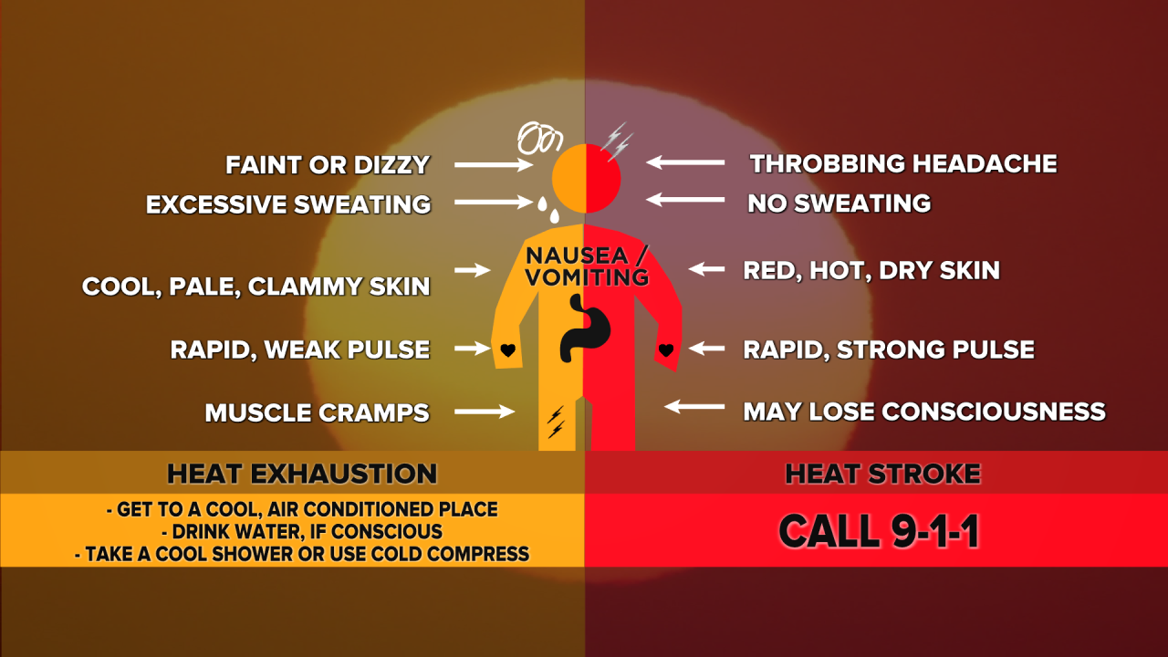
We are under an Excessive Heat Warning from 10 AM Friday - 8 PM Saturday. Heat index values both days will be 110°+. That’s dangerous heat that could easily cause heat exhaustion or heat stroke. Listen to your body, know the signs, and limit that time outdoors.
Looking for some relief in the form of afternoon storms? Unfortunately, Friday won’t have any as it will be a mostly dry day. Saturday has some uncertainty with it. Models are split between us seeing scattered storms in the afternoon/evening and us staying mostly dry. If we do see thunderstorms develop, some could become strong to severe. That’s why most of the region is under a Level 1 of 5 risk for severe storms Saturday PM.

More scattered showers and storms are expected Sunday around a cold front. This front will bring us some much needed relief from this high heat and humidity for a little while. Highs on Sunday in the upper 80s, feeling like the upper 90s, will drop to highs in the low to mid 80s, feeling like the mid 80s, for much of the next workweek.

The first half of next week is looking mostly dry with a mix of sun and clouds. Isolated storms return later in the week on Thursday.
Connect with Meteorologist Kristy Steward:
FACEBOOK
TWITTER
INSTAGRAM
