


Meteorologist Kristy Steward's First Warning Forecast
Happy Friday evening! It was beyond hot outside today and Saturday will be much of the same. A cold front this weekend could bring severe storms before it provides relief from this heat.
High temperatures Saturday reach the upper 90s, feeling like 110-115°. Our Excessive Heat Warning continues until 8 PM Saturday. Limit your time outdoors and keep yourself and your pets cool!

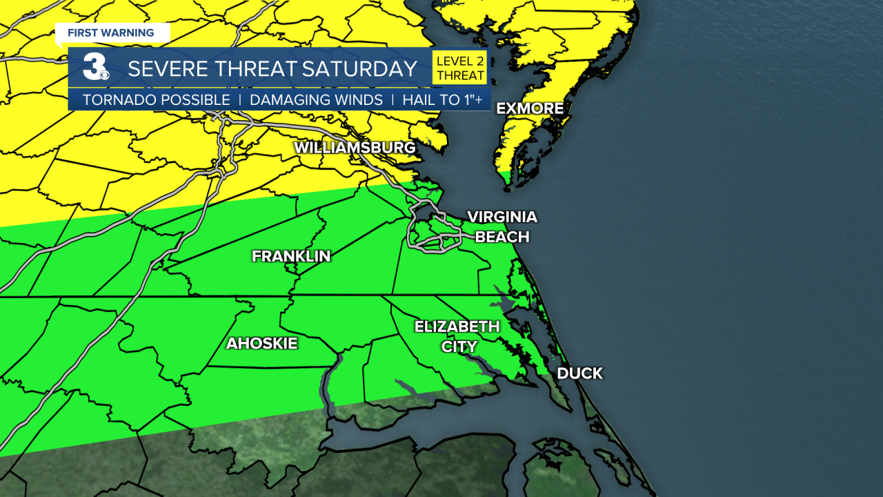
Later Saturday, after 5 PM, we could have a round of potentially severe thunderstorms roll through. The Eastern Shore and Middle Peninsula are under a level 2 of 5 risk for severe storms. Elsewhere is under a level 1 risk. Damaging wind gusts and heavy downpours leading to localized flash flooding are the primary threats.

Rounds of scattered showers and thunderstorms will continue throughout Sunday around the cold front. Sunday will be cooler with highs in the upper 80s, feeling like the upper 90s.
The real heat relief comes during the workweek. Highs most of next week will be in the mid 80s with low humidity. Friday is when temperatures and humidity begin to rise again. Much of next week looks decently dry aside from a few spotty storms.
Connect with Meteorologist Kristy Steward:
FACEBOOK
TWITTER
INSTAGRAM
