

Meteorologist April Loveland's First Warning Forecast
A HEAT ADVISORY is in effect until 7 PM

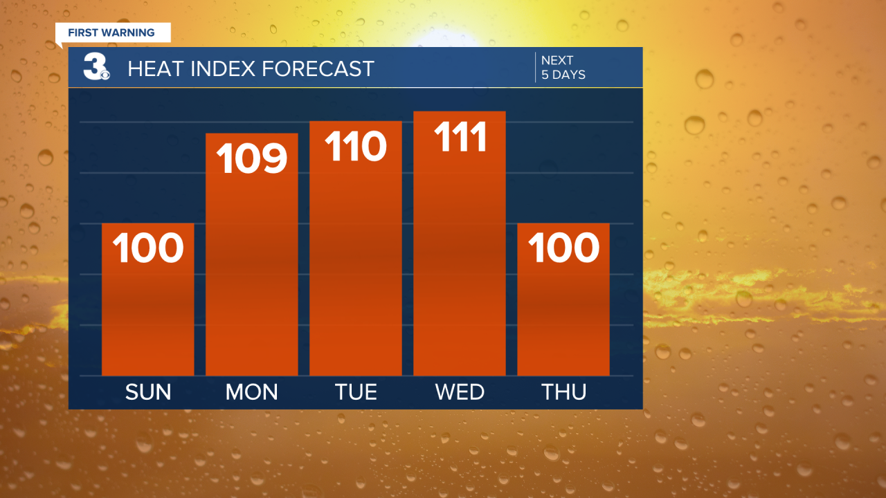
Drier today, but temperatures will be on the rise. Highs will soar to the low 90s, with heat index values near 101°. There is a slight chance for a spotty afternoon shower or storm. Today, will not be a washout by any means.
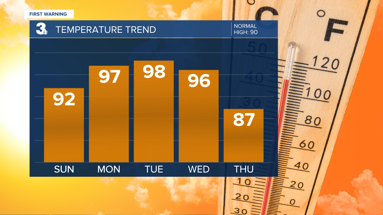
The heat will continue to turn up on Monday. Temperatures will warm to the mid 90s, but it will feel closer to 110°! Skies will be mostly sunny and rain chances will remain low.
The dangerous heat will stick around on Tuesday and Wednesday. Highs rise to the mid and upper 90s with feels-like temps 110°+.
A few storms will be possible late Wednesday.
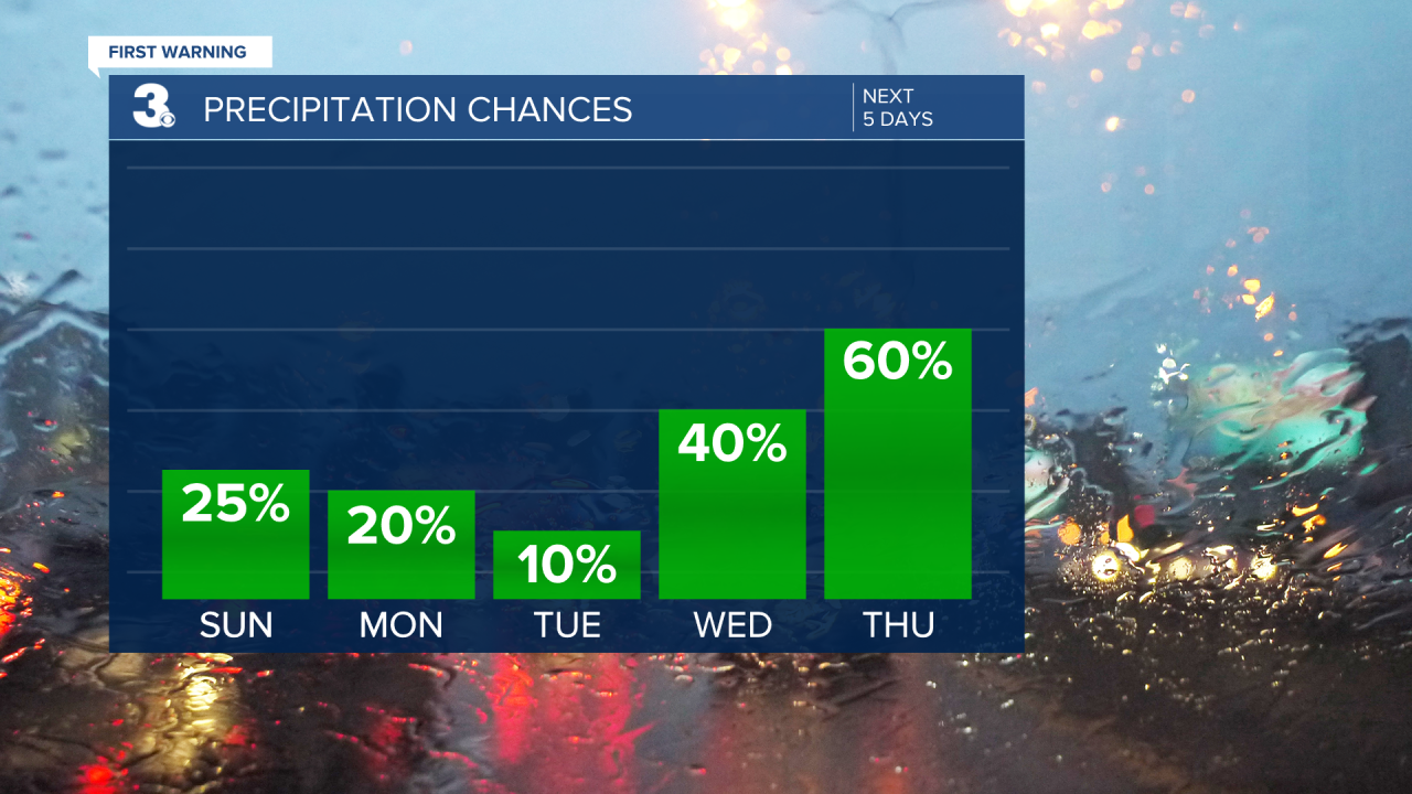
Better chances for wet weather on Thursday and Friday. Scattered storms will be possible on Thursday with high temperatures falling into the mid 80s. Expect scattered storms on Friday with highs in the low and mid 80s.

Meteorologist April Loveland
For weather updates on Facebook: HERE
Follow me on Twitter: HERE
Follow me on Instagram HERE
Check out the Interactive Radar on WTKR.com: Interactive Radar
