

Meteorologist April Loveland's First Warning Forecast
Our next storm system moves in on Tuesday. This will bring showers by the afternoon and evening hours. Temperatures will warm to the mid 70s.

Expect showers and storms to stick around on Wednesday. It will be our warmest day with highs near 80 degrees.
Thursday is looking mostly dry with highs in the mid 70s. Skies will be partly cloudy.

Another storms system will move in for the end of the week. Expect a chance of showers later in the day with highs in the mid 70s.
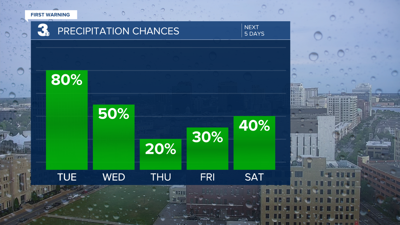
Looks like showers and storms will be possible on Saturday. Temperatures will warm to the mid and upper 70s.
Sunday is looking like the pick day of the weekend. Temperatures will top out in the mid and upper 70s under partly cloudy skies.

Meteorologist April Loveland
For weather updates on Facebook: HERE
Follow me on Twitter: HERE
Follow me on Instagram HERE
Check out the Interactive Radar on WTKR.com: Interactive Radar
