

Meteorologist April Loveland's First Warning Forecast
Lots of sunshine today, but it will be deceiving! Temperatures will warm to the mid 30s, but wind chills will be in the twenties.
If you're not a fan of the winter chill, a warming trend will start on Monday.

The Climate Prediction Center is also forecasting warmer than normal conditions through the end of January.
Monday will be mostly sunny with highs in the mid 40s. Morning lows will also trend upward.
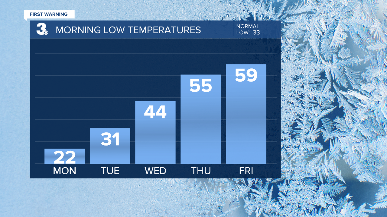
Rain chances will remain low on Tuesday, but we'll see more clouds than sunshine. Highs will soar to the mid 50s, which is above normal for this time of year.
Get ready for even warmer weather!
We'll enter a soggy stretch by midweek, but it will also feel more spring-like.

Temperatures will soar to the mid 60s on Wednesday with scattered showers possible.
Wet weather will continue on Thursday with highs near 70 degrees! Another mild day Friday with highs in the upper 60s to near 70. Unfortunately, we will have to deal with some showers, but at least it will be mild.

Meteorologist April Loveland
For weather updates on Facebook: HERE
Follow me on Twitter: HERE
Follow me on Instagram HERE
Check out the Interactive Radar on WTKR.com: Interactive Radar
