


Meteorologist April Loveland's First Warning Forecast
FLOOD WATCH: In effect from noon Saturday through Saturday evening.
We finally say goodbye to Debby, but now we've got a cold front to contend with this weekend.
Expect afternoon storms to pop up, especially across North Carolina. If you have any outdoor plans, you might want to keep an umbrella handy.

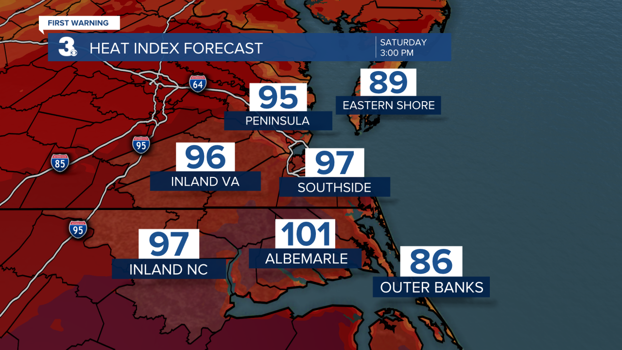
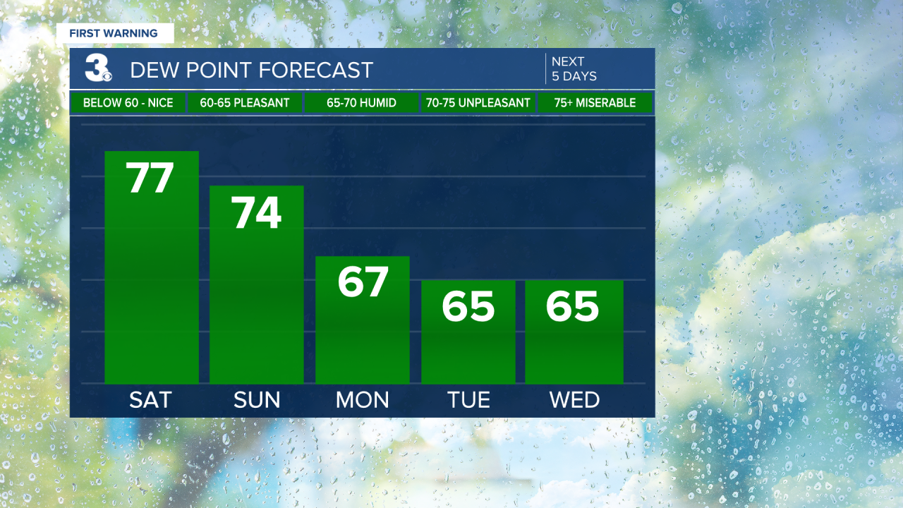
It will be hot and humid with highs in the mid and upper 80s, and heat index values warming to the 90s to 100.
Moving into Sunday, those scattered storms stick around, but temperatures cool off slightly to the low and mid 80s. It will still be on the humid side, but not quite as bad as Saturday.

By Monday, things start to clear up with partly cloudy skies and dry conditions. Temperatures will stay below normal, with highs in the low 80s.

On Tuesday, afternoon storms make a return with highs in the low 80s.

Wednesday brings more spotty storms. High temperatures will remain in the low 80s with pretty comfortable humidity levels.
Expect partly cloudy skies on Thursday with a slight chance of a passing shower. Highs will trend in the low and mid 80s.
Finally, Friday wraps up the week with scattered storms once again. Keeping a slight 30 percent chance. Temperatures will hold steady in the low 80s.

Tropical Update:
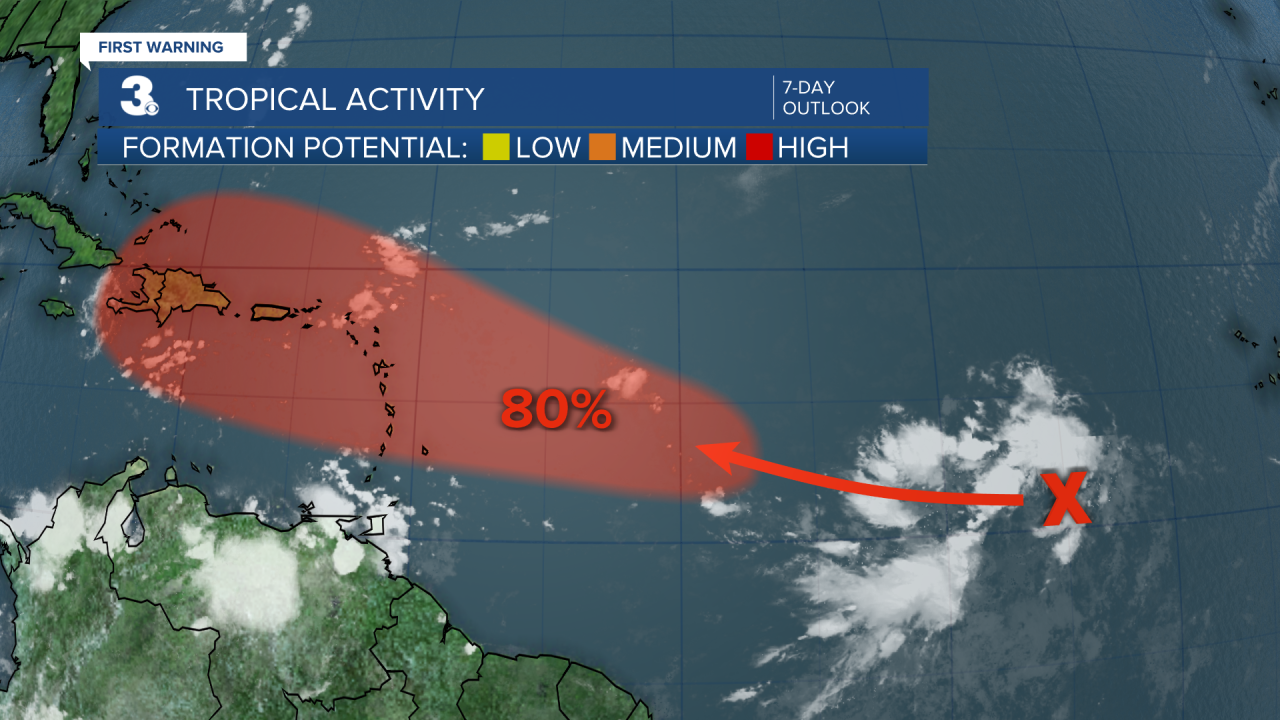
Shower and thunderstorm activity has increased some in association with a tropical wave located roughly halfway between the Cabo Verde Islands and the Lesser Antilles. Gradual development of this system is possible during the next couple of days
The system is forecast to continue moving generally west-northwestward and could approach portions of the Greater Antilles by the middle to latter part of next week.
* Formation chance through 2 days: LOW (20%)
* Formation chance through 7 days: HIGH (80%)
Meteorologist April Loveland
For weather updates on Facebook: HERE
Follow me on Twitter: HERE
Follow me on Instagram HERE
Check out the Interactive Radar on WTKR.com: Interactive Radar
