

Derrah Getter's First Warning Forecast
This evening a few isolated showers are possible but we'll mainly be dry. Rain chances increase overnight with isolated storms possible early Sunday morning.

A level 2 out of 5 severe weather threat is in place for Sunday. While not everyone will see rain those of us that do could see strong storms capable of producing locally damaging wind gusts and localized flooding. More storms are possible on Monday with a level 1 out of 5 severe weather threat taking effect.

Behind the cold front the weather will be reminiscent of fall. High temperatures starting Tuesday will be in the 70s with very low humidity. Aside from Monday, it's going to be a great week weather-wise for the students returning to school.

Tropical Update
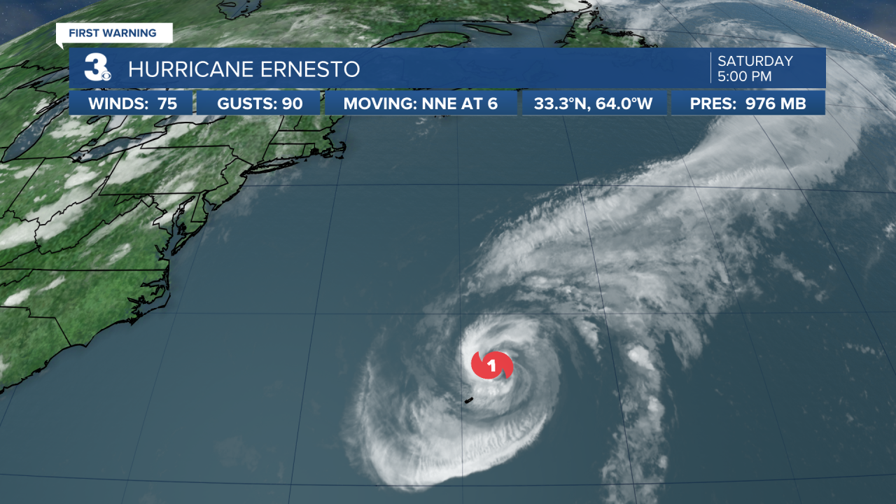
As of 8/17/24 at 6 pm
Hurricane Ernesto has slowed down while moving away from Bermuda and is now a category 1 hurricane. As it continues a north-northeasterly motion well offshore of the U.S. east coast, it will continue to cause dangerous beach conditions through early next week. A high rip current risk is expected Sunday and Monday.
Let's connect on social media!
Forecaster Derrah Getter:
For weather updates on Facebook: HERE
For weather updates on Twitter: HERE
Follow me on Instagram: HERE
Check out the Interactive Radar on WTKR.com: Interactive Radar
