


Meteorologist April Loveland's First Warning Forecast
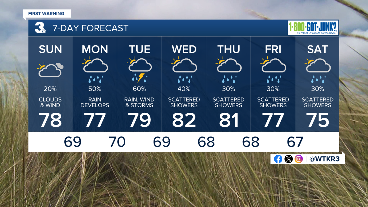
Today will be another day where we'll see more clouds than sunshine, with a slight chance of a spotty shower across North Carolina. Temperatures will warm to the upper 70s. It will be windy, with winds out of the northeast at 10-20 mph and gusts up to 30 mph.

We continue to watch an area of low pressure off the southeast coast. This system has the potential to become tropical or subtropical over the next day or so, but no matter what, it is expected to bring rain, wind, and flooding to the area.
Winds will continue to ramp up to kick off the work week. Winds will be out of the northeast at 15-25 mph with gusts up to 30 mph possible. Rain will move in by late Monday afternoon and evening, becoming heavier as the night goes on. It will be muggy with highs in the mid and upper 70s.

Heavy rain and possible storms will continue into Tuesday. It will continue to be windy. With these persistent northeasterly winds, tidal flooding and coastal flooding are likely. It will be humid with highs in the upper 70s.

Showers will continue on Wednesday. Temperatures will warm to the low 80s.
The unsettled stretch of weather will continue on Thursday, Friday, and Saturday. Scattered showers and storms will be possible on Thursday, with highs in the low 80s. Temperatures will cool to the mid and upper 70s on Friday and Saturday, with a few showers and storms possible. Overall, we could see 2-3+ inches of rain for the work week.
Meteorologist April Loveland
For weather updates on Facebook: HERE
Follow me on Twitter: HERE
Follow me on Instagram HERE
Check out the Interactive Radar on WTKR.com: Interactive Radar
