

Meteorologist April Loveland's First Warning Forecast
A cloudy and showery day as a coastal low impacts the area. Expect light showers and drizzle throughout the day, especially along the coast.

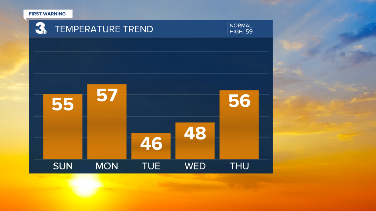
Temperatures will trend closer to normal today. Highs will warm to the low and mid 50s along the coast. It will be a little cooler inland with temperatures in the 40s.
It will warm to the mid and upper 50s to kick off the work week. A big cool down on Tuesday and Wednesday. Temperatures will only warm to the mid and upper 40s.
We are tracking some of the coldest air we've felt so far this season. Morning lows will be in the low 40s through Monday, but by Tuesday morning, you'll be waking up to temperatures near the freezing mark.
Even colder Wednesday morning as temperatures drop into the 20s! Brr!

After Sunday, conditions will dry out. We are dealing with severe drought conditions in some of our area. Good news though. The precipitation forecast for December is looking wetter than normal. The next chance for wet weather will be late Friday into early Saturday.

Meteorologist April Loveland
For weather updates on Facebook: HERE
Follow me on Twitter: HERE
Follow me on Instagram HERE
Check out the Interactive Radar on WTKR.com: Interactive Radar
