


Meteorologist Kristy Steward's First Warning Forecast
Happy Thursday evening! We’re in for a cloudy, but warm weekend. Rain eventually moves in too.
Tonight, clouds begin building well ahead of our next rainmaking system. Overnight lows will be warmer in the upper 30s to low 40s.
Friday will be mostly cloudy, but mostly dry. Temperatures warm into the low 60s.

We stay with a lot of cloud cover Saturday, but that doesn’t stop temperatures from soaring into the upper 60s. Saturday’s rain chances are a bit on the fence. Right now, it looks like just a few isolated showers popping up in the afternoon. However, one model is showing a round of scattered showers across our northern communities. We’ll continue to monitor that chance and keep you updated.
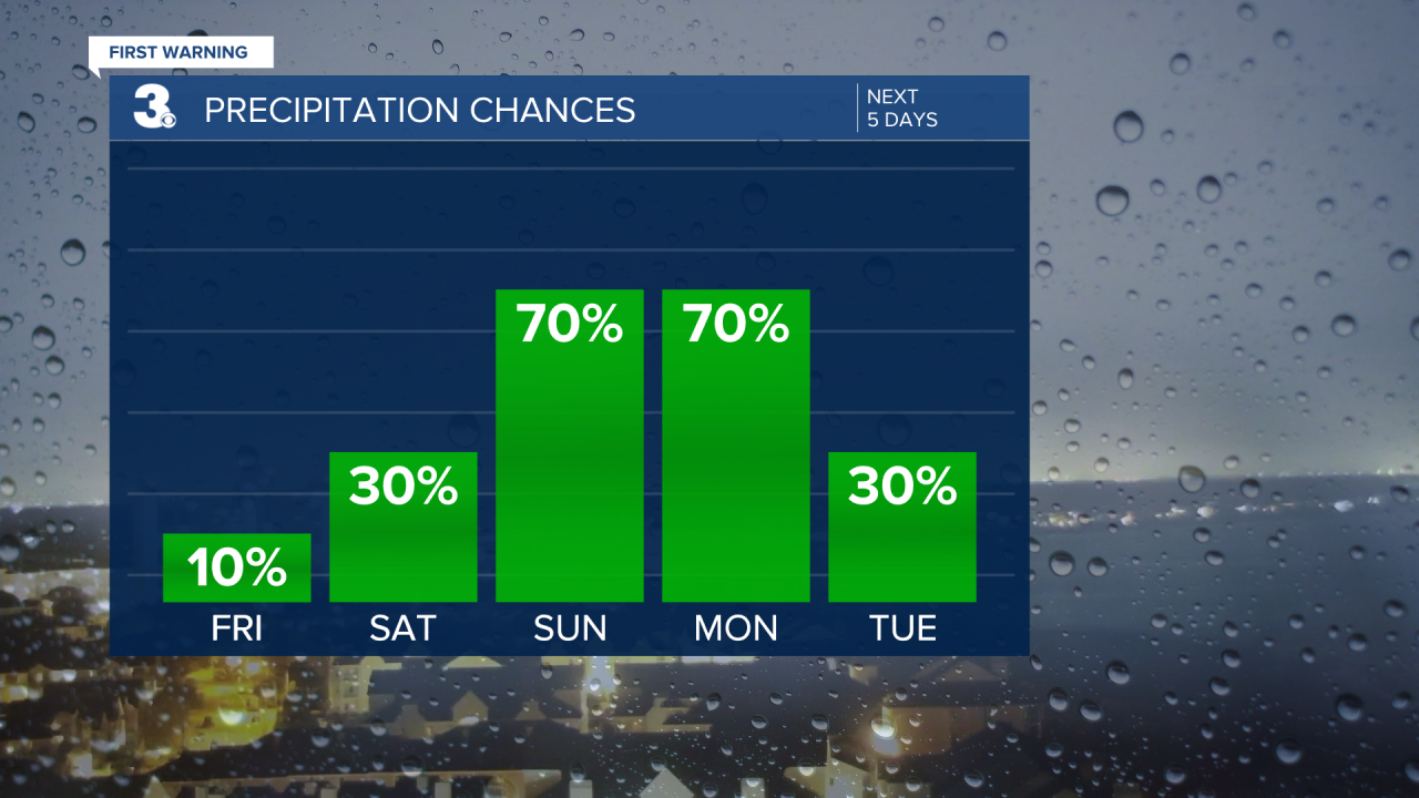
Sunday and Monday is when we’ll have scattered to widespread rain moving through that could dump 1-2” of rain. Temperatures will begin cooling down. Highs Sunday around 60° become highs in the mid 50s Monday.

Tuesday is the coldest day ahead. Highs in the upper 40s and windy following this system. Throughout Tuesday, we’ll dry out and clouds will clear out.
This means Valentine’s Day will be nice and sunny! It will be a mild holiday. Dry with highs in the low to mid 50s. Overnight lows cool into the mid 30s. Similar weather continues for Thursday.
Connect with Meteorologist Kristy Steward:
FACEBOOK
TWITTER
INSTAGRAM
