


Meteorologist Kristy Steward's First Warning Forecast
Good Sunday evening! It’s been soggy most of the day, but the workweek is looking brighter! However, it will be a cold sunshine.
Some lingering showers will clear out late tonight and clouds clear out Monday morning. We’ll wake up to temperatures in the low to mid 40s. Highs reach the mid to upper 50s. Around a dry cold front, winds will be breezy. Westerly winds 10-25 MPH.
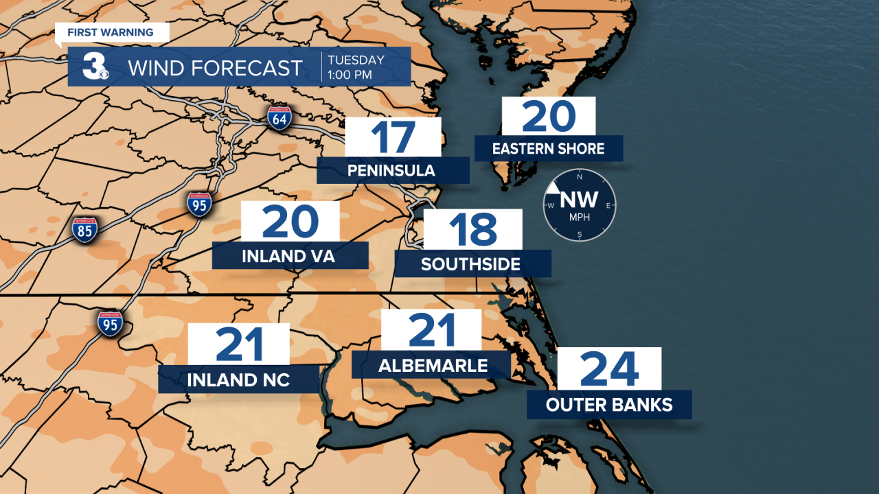
Following the front, we get cold. Temperatures Tuesday morning in the low to mid 30s warm to the mid to upper 40s in the afternoon. Then, temperatures fall into the mid 20s Tuesday night. Protect anything outdoors that may be sensitive to the cold. Temperatures Wednesday afternoon reach the mid 40s.

Sunshine continues through Thursday. Thursday also kicks off a warming trend. Highs reach the mid 50s.

Friday through the weekend we move into an unsettled pattern. We have daily isolated to scattered rain chances Friday through Sunday. Temperatures will be seasonable with highs in the upper 50s to low 60s this weekend.
Connect with Meteorologist Kristy Steward:
FACEBOOK
TWITTER
INSTAGRAM
