


Chief Meteorologist Patrick Rockey's First Warning Forecast
After highs back near 80 degrees on Thursday, our weather roller coaster is about to plunge once again.
A powerful cold front will cross the region overnight, bringing sharply cooler temperatures, plenty of clouds and (maybe) a little rain.
How cool is it going to get. Most of us will be 20 to 25 degrees cooler on Friday afternoon compared to Thursday.

And while that is a big drop in temperatures, Friday's highs will be a lot closer to normal for the first half of November.
That cold front will also bring plenty of cloud cover. And while we need rain, we're not expecting much. A few lucky folks may get a few light showers, but it won't be much.
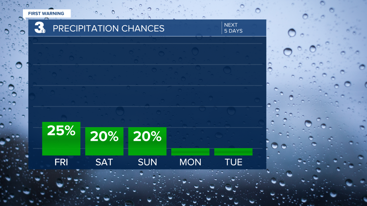
And the mainly dry weather will stick around for the weekend. A stray shower isn't out of the question either day, but unlikely.
A little piece of energy will move up the Carolina coast, bringing a slight chance for some showers for the Outer Banks on Sunday. But it looks like raindrops will be few and far between.

Our skies should clear and our temperatures should slowly warm as we head through the work week. In fact, by the end of the work week, we'll be flirting with the 70-degree mark again.
