


Meteorologist Kristy Steward's First Warning Forecast
Happy Wednesday evening! We had an absolutely gorgeous day with cooler temperatures in the low to mid 80s, no humidity, and no rain! We’ll have a couple more nice days before heat and humidity begins to build again.
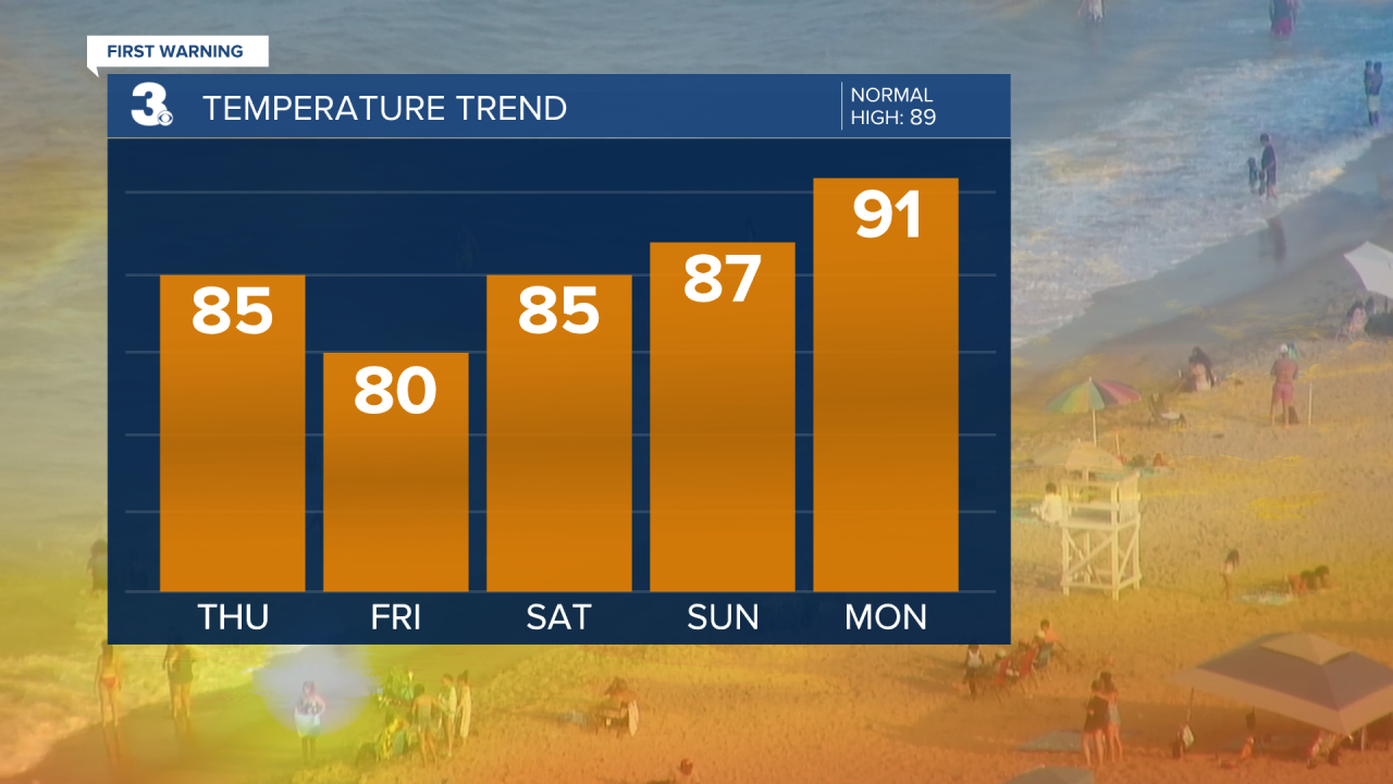
Thursday will be very similar to today. In fact, you may even need to grab a jacket in the morning! Temperatures will be in the mid 60s with no humidity. Highs rise to the mid 80s and again, still no humidity. We could have a spotty shower in the afternoon, but most areas look to stay dry all day.
High pressure moves out and a cold front approaches Friday. This shift in our pattern will bring us scattered showers and storms Friday afternoon and evening. Temperatures will be a little cooler around 80°, but humidity starts to rise.

This weekend temperatures and humidity continue to gradually rise. Highs in the mid to upper 80s with dew points in the upper 60s to low 70s, so you’ll begin to feel the humidity again. A few lingering showers Saturday morning, but overall it looks like a mostly dry weekend.

Next week is when the high heat and humidity returns. Highs in the low 90s, feeling like the triple digits. The first half of the week looks decently dry, just spotty to isolated storms possible Monday afternoon and evening.
Connect with Meteorologist Kristy Steward:
FACEBOOK
TWITTER
INSTAGRAM
