

Meteorologist April Loveland's First Warning Forecast
Cloudy, foggy and showery this morning. Expect the fog to hang around, especially along the coast for the next few hours. We will have more clouds than sunshine and a big temperature gradient. The Peninsulas and Eastern Shore will have highs in the 50s, while the Southside will have highs in the 60s and then the 70s across North Carolina. A few showers will be possible later this afternoon. Today will not be a washout, just won't be super pretty. '

Clouds will hang around overnight with lows in the low 40s. A few showers will be possible, especially on the Peninsulas.
Temperatures will take a plunge to kick off the work week. Expect highs in the mid and upper 40s for both Monday and Tuesday. It will be windy and cold Monday with winds out of the northwest at 15-20 mph. Wind chills will be in the 30s.
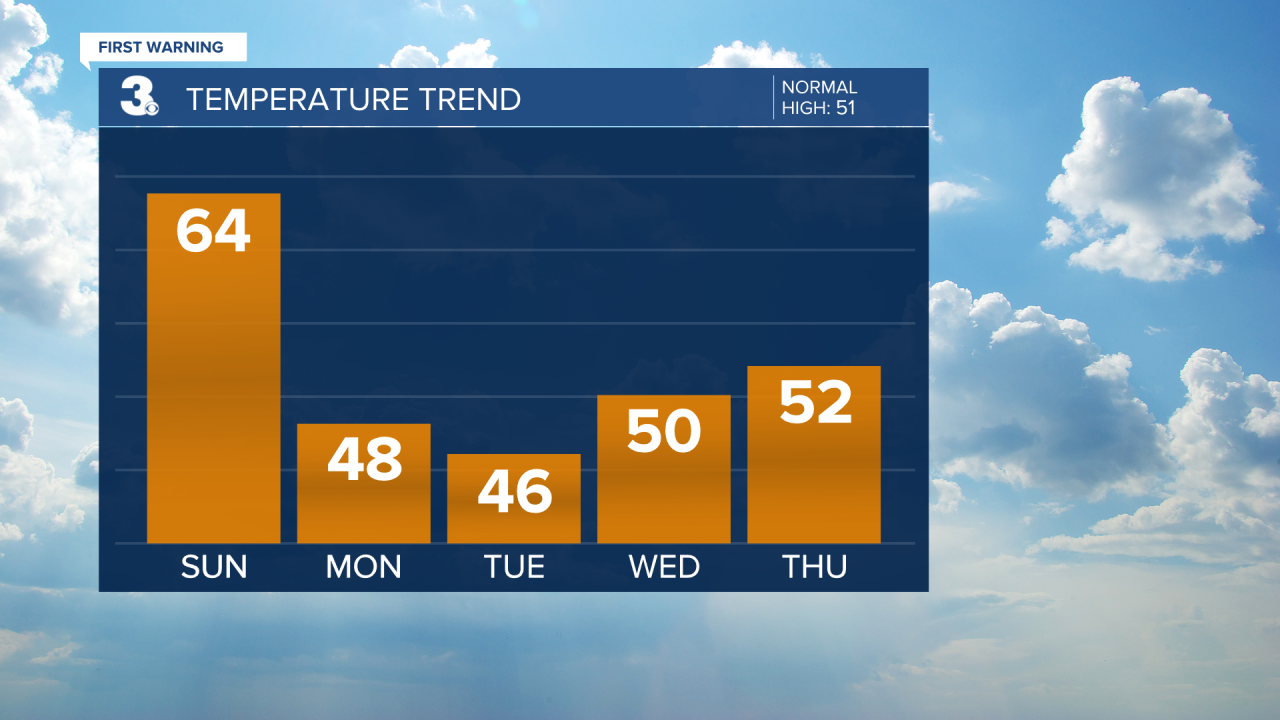
We could see a few showers on Wednesday with highs near 50.

Partly cloudy with highs in the low 50s on Thursday.
We'll warm to the mid 50s with a nice mix of sun and clouds on Friday.
If you're heading out to the Polar Plunge on Saturday, temperatures will warm to near 50. Right now, the water temperature is around 46 degrees.

Meteorologist April Loveland
For weather updates on Facebook: HERE
Follow me on Twitter: HERE
Follow me on Instagram HERE
Check out the Interactive Radar on WTKR.com: Interactive Radar
