

Meteorologist April Loveland's First Warning Forecast

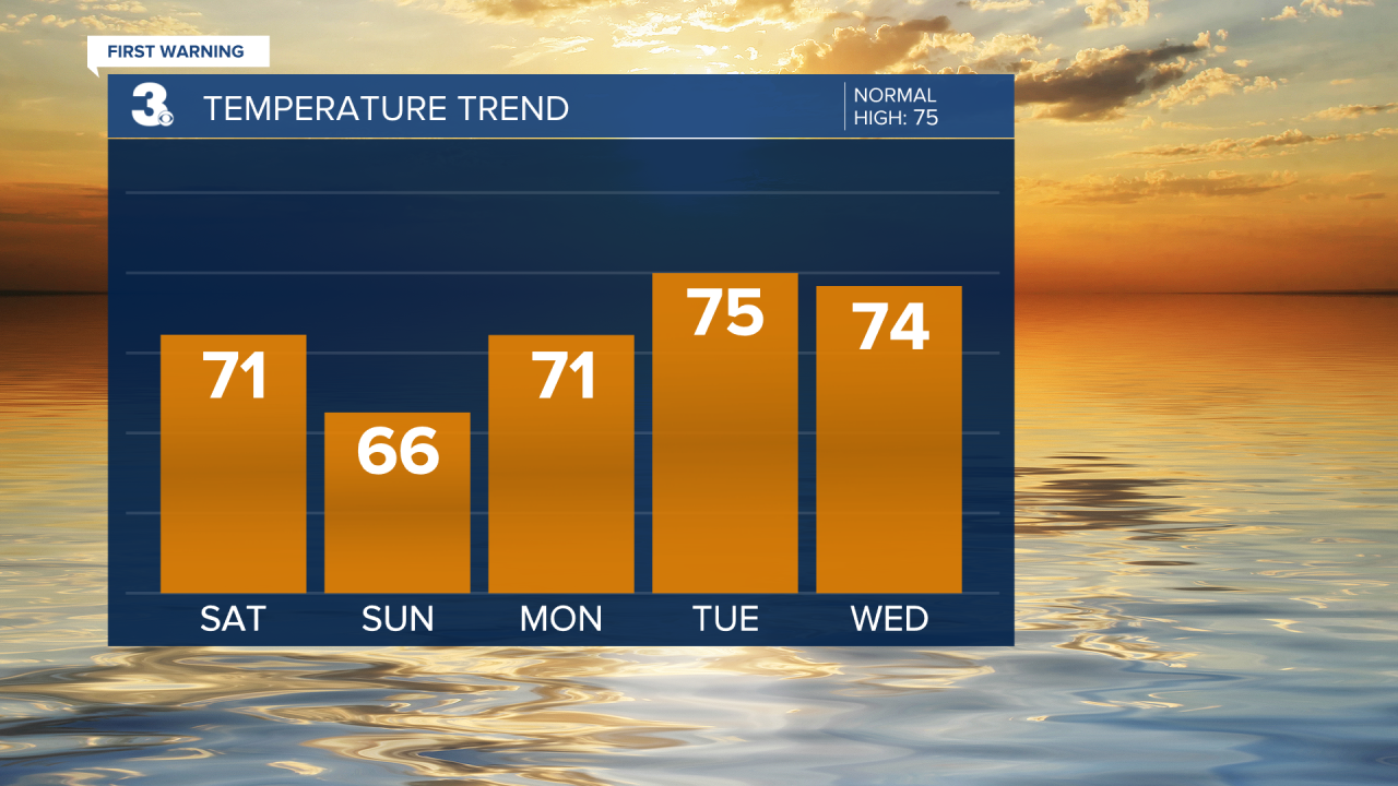
A strong cold front will move in today. Expect a few showers this afternoon. A rumble of thunder is also possible. Temperatures will warm to the low 70s and then drop quickly after the cold front moves through. Winds will pick up a bit out of the northwest.

Clear and chilly conditions overnight. Temperatures will fall into the 40s! It won't be the coldest night though. Monday will be even cooler with lows in the mid 40s. Some upper 30s may even be possible inland. After that, morning lows will start to trend upward, even though they will still be on the cool side for this time of year.

The week is looking sunny and dry with temperatures gradually warming into the mid and then upper 70s by the end of the week.
Rain chances will remain low through Thursday. We could see some scattered showers by Friday.
Meteorologist April Loveland
For weather updates on Facebook: HERE
Follow me on Twitter: HERE
Follow me on Instagram HERE
Check out the Interactive Radar on WTKR.com: Interactive Radar
