


Meteorologist Kristy Steward's First Warning Forecast
Happy Friday evening! A cold front is on the way, cooling us down and starting our roller coaster ride of temperatures for the upcoming week.
A shower or two might get squeezed out around this front, but there’s not a lot of moisture associated with it, so we’re really just looking at passing clouds with this front.
Humidity and temperatures begin dropping behind the front. Lows tonight in the upper 60s. Highs Saturday in the mid 80s. It will feel wonderful to be outside Saturday as there won’t be any noticeable humidity in the air!

Temperatures and humidity start rising on Sunday. It will still be a pleasant day with tons of sunshine, but a little warmer with highs around 90° and slightly noticeable humidity.

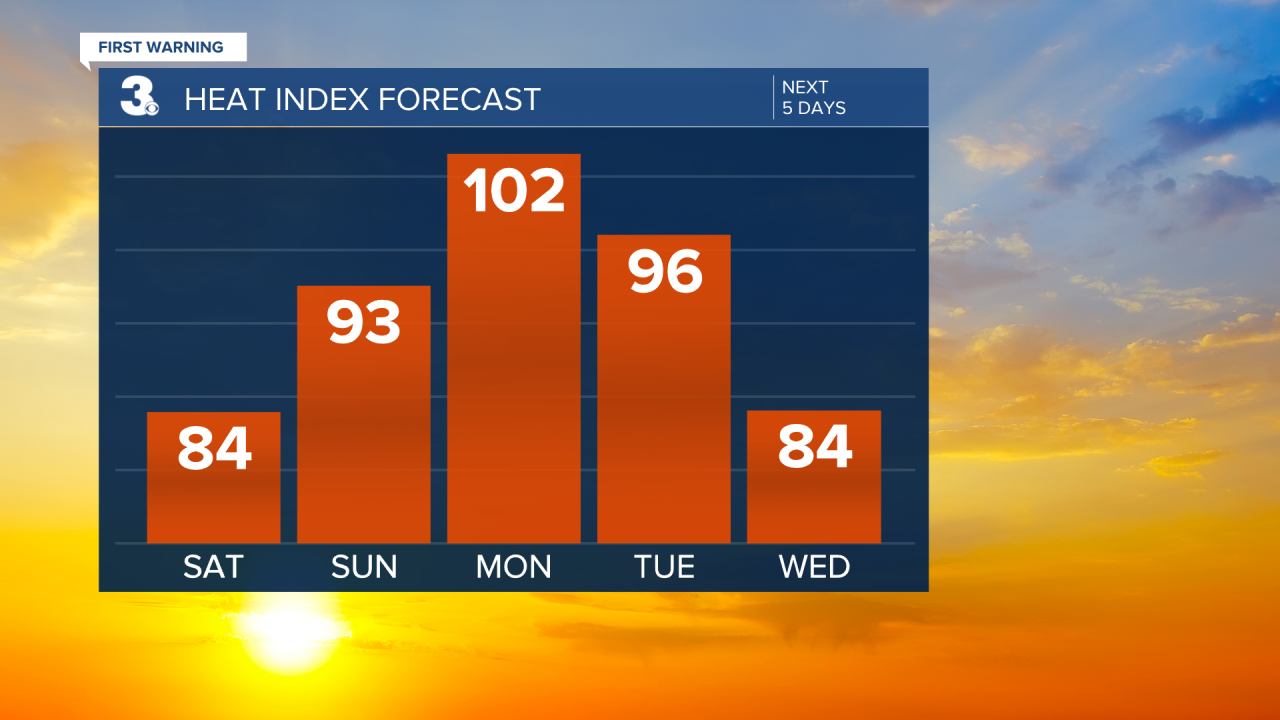
Sticky air returns Monday and Tuesday ahead of another approaching cold front. Monday will be the hottest day with highs in the mid 90s feeling like 100-105°. Tuesday starts to cool down with highs in the upper 80s.
We notice the full effects of that second cold front Wednesday. Highs in the mid 80s and very low humidity again. Enjoy it because temperatures rise back to the low 90s by Friday.
All weekend and week long will be dry with lots of sunshine. Our next greatest chance for rain looks to be next Friday evening.
Connect with Meteorologist Kristy Steward:
FACEBOOK
TWITTER
INSTAGRAM
