

Meteorologist April Loveland's First Warning Forecast
Kicking off the weekend with clearing skies and comfy highs in the low 80s. Looking like a mostly dry day, so it's perfect for any outdoor plans you have. Grab those sunglasses and enjoy!
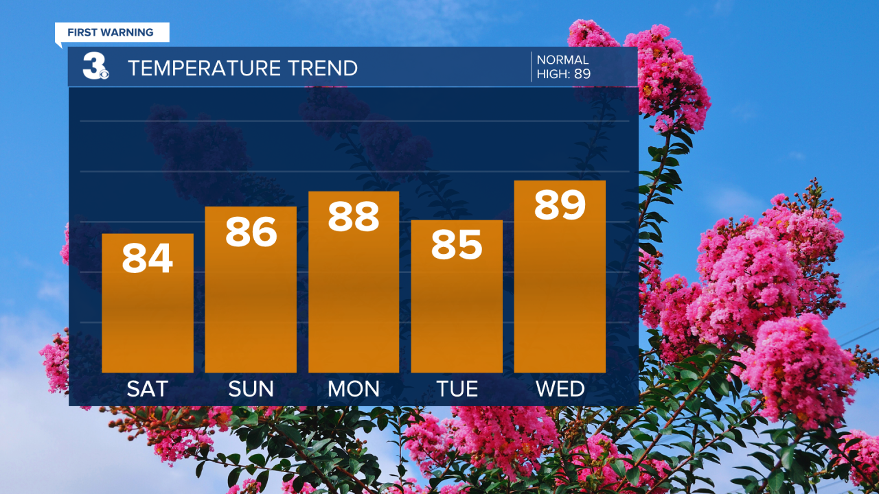
If you loved Saturday, you're going to adore Sunday. It's a sunshine extravaganza! It will continue to be a comfortable day with highs in the mid 80s.
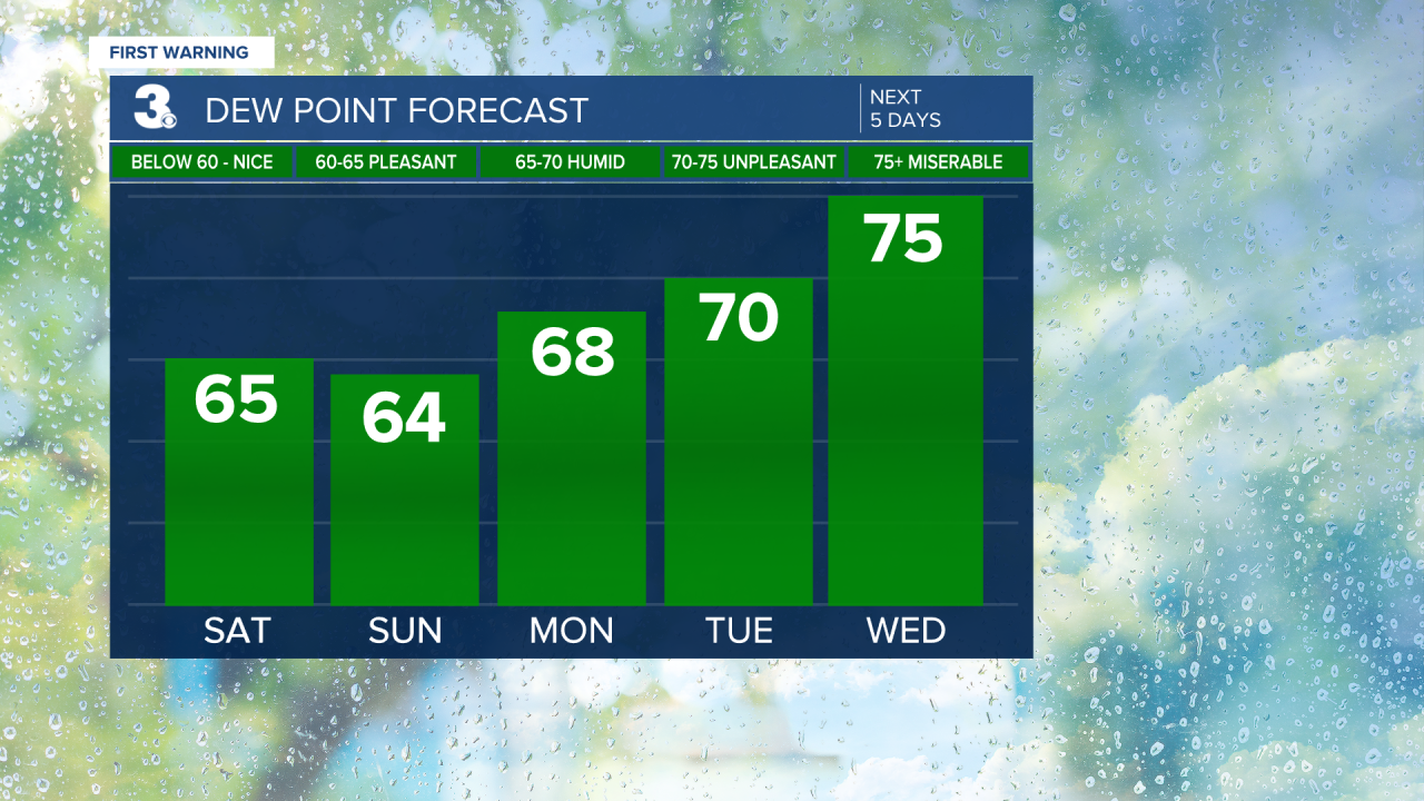
Things start to heat up as we enter the week, with a high of 88°F. There's a 20% chance of spotty showers, but nothing too serious. Just a sprinkle here and there—keep an umbrella handy just in case.
A little bit better chance on Tuesday. Keeping a 30% chance of isolated storms. Temperatures drop slightly to 85°F. Keep an eye on the sky if you’re out and about!
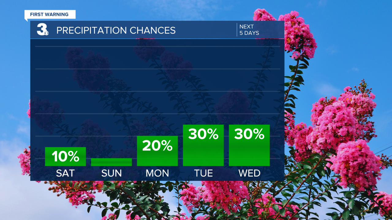
Similar story to Wednesday with isolated storms making an appearance, and the temperature bouncing back up to the upper 80s.
Things are getting steamy on Thursday! With a high of 90°F and a chance of isolated storms, it’s a classic summer day. Stay cool and hydrated out there.
Wrapping up the week with a sizzle! A hot and humid 92°F and a 25% chance of rain.

Meteorologist April Loveland
For weather updates on Facebook: HERE
Follow me on Twitter: HERE
Follow me on Instagram HERE
Check out the Interactive Radar on WTKR.com: Interactive Radar
