

Meteorologist April Loveland's First Warning Forecast
Some lingering showers will be possible overnight and into Wednesday. A FLOOD WATCH is in effect through early Wednesday.
We'll see some improvement on Wednesday. Patchy fog will be possible during the morning hours. Expect more clouds than sunshine with a spotty shower here and there. Temperatures will warm to the low 80s, the only day with highs near normal.
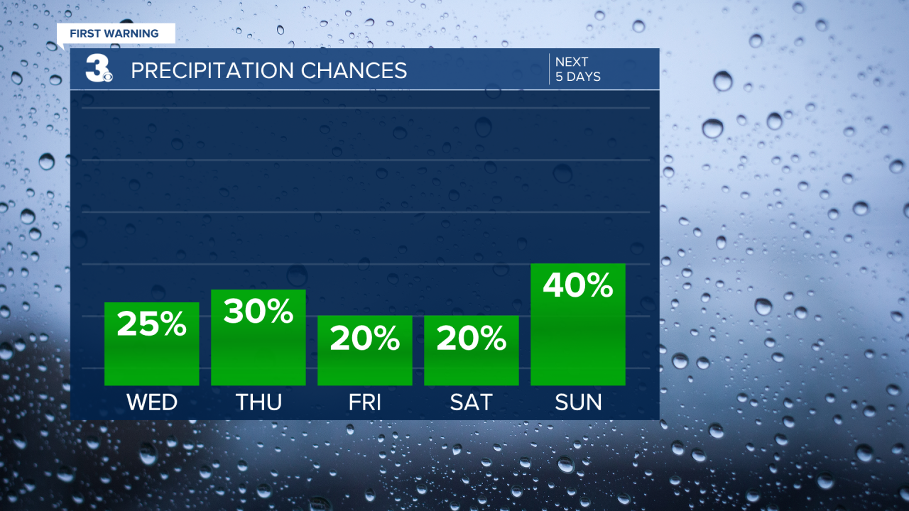
Expect another day with more clouds than sunshine on Thursday. Highs will top out in the upper 70s, with a few scattered showers expected.
Friday will be partly cloudy to end the work week. The day looks mainly dry with highs in the upper 70s.
The weekend is looking 50/50. It will be breezy both Saturday and Sunday. Right now, Saturday looks like the better day with highs in the mid-70s under partly cloudy skies.
Showers will move in on Sunday with highs in the low 70s.
It looks like we should dry out by the start of the work week, with a mix of sun and clouds and highs in the low 70s on Monday and the upper 70s on Tuesday.

Meteorologist April Loveland
For weather updates on Facebook: HERE
Follow me on Twitter: HERE
Follow me on Instagram HERE
Check out the Interactive Radar on WTKR.com: Interactive Radar
