

Meteorologist April Loveland's First Warning Forecast
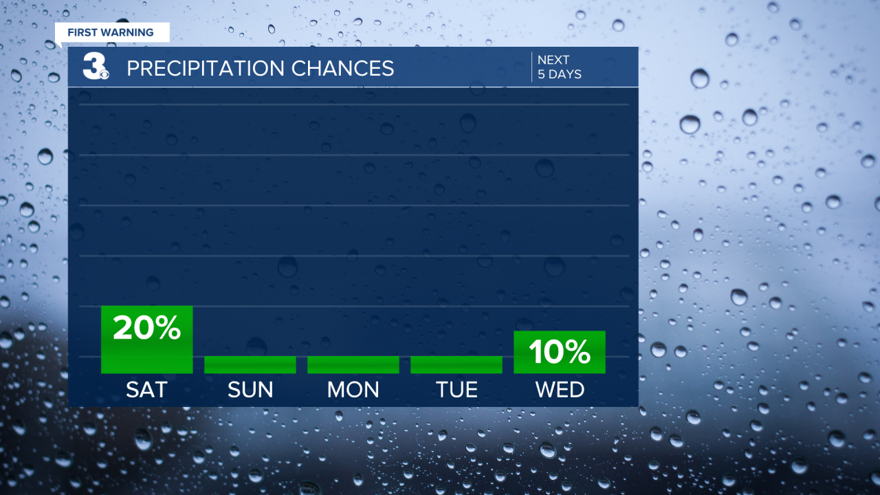
A chilly, but dry weekend on tap.

Winds will pick up today out of the northwest. This will make temperatures feel a bit chillier. Expect highs in the mid 40s. We'll see a nice mix of sun and clouds.
A cold night on tap. Many areas will fall into the 20s! It's been awhile since we've gotten this cold.
After a frigid start Sunday, temperatures will rebound to the upper 40s. It will still be a little on the breezy side. Skies will be partly cloudy.
More sunshine will break out for President's Day. Temperatures will warm to near 50.
The warming trend will continue on Tuesday with highs in the low 50s, which is close to normal for this time of year.
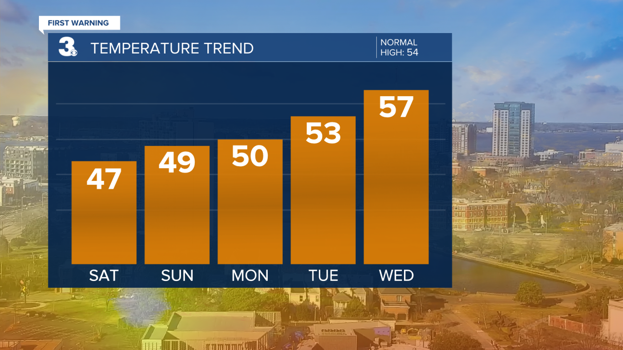
We'll warm to the mid and upper 50s by Wednesday. Rain chances will remain low.
Temperatures will soar to the low 60s on Thursday. Most of the day will be dry. Showers will move in late.
Scattered showers to end the work week. Highs will warm to the mid and upper 50s.

Meteorologist April Loveland
For weather updates on Facebook: HERE
Follow me on Twitter: HERE
Follow me on Instagram HERE
Check out the Interactive Radar on WTKR.com: Interactive Radar
