


Meteorologist Kristy Steward's First Warning Forecast
Happy Thursday evening! We were a step warmer today and noticed increasing clouds this afternoon. A cold front is coming with some changes.
We have a disturbance traveling north along the coast this evening. That will bring us a round of scattered rain showers this evening into tonight. With additional cloud cover, temperatures will be warmer overnight. Lows in the upper 50s.
Ahead of the front, Friday will be another couple degrees warmer with highs in the low to mid 70s. We should be dry by the Friday morning commute, but still grab an umbrella as you head out the door. Wet weather will likely impact your evening commute. We’ll have some midday sunshine before clouds increase and more scattered showers/storms start passing through from the west around 4 PM. Scattered rain continues through the night, clearing out by sunrise Saturday.

This weekend is looking better. Mostly dry with plenty of sunshine. A little windy with 10-20 MPH winds gusting to 30 MPH. It will also be a bit cooler behind the front. Highs Saturday in the upper 60s. Highs in the mid to upper 60s Sunday.
Monday is the coldest day ahead. Grab a coat to kick off the work week! Temperatures will be in the mid 40s to start the day, warming up into the low 60s by the afternoon.
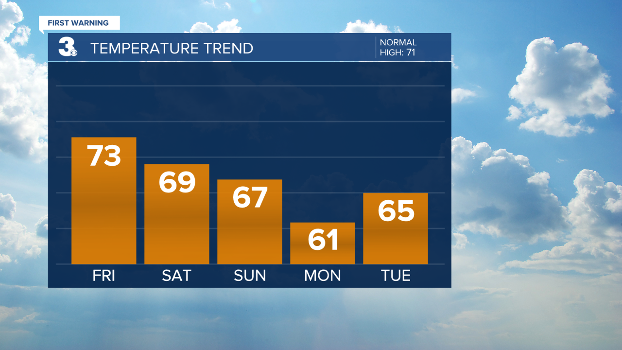
As high pressure settles in from the north, we’ll get to enjoy a dry, mostly sunny week. Temperatures will gradually warm up to the mid 60s Tuesday and the seasonable low 70s the second half of the week.
Connect with Meteorologist Kristy Steward:
FACEBOOK
TWITTER
INSTAGRAM
