


Chief Meteorologist Patrick Rockey's First Warning Forecast
After a week of wild swings, temperatures will settle down heading into the Veterans Day weekend. But we'll be settling for below-normal temperatures.
A powerful cold front crossed the region early Friday morning, bringing clouds, a few raindrops and a 20-30 degree temperature drop.

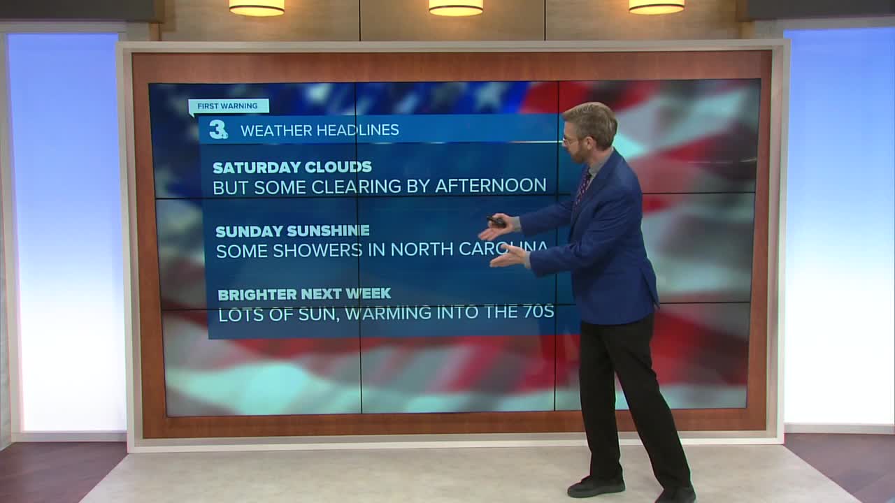
Veterans Day will start off on the cloudy and cool side. But by the afternoon, we'll see a bit more sunshine, especially in our northern communities in Hampton Roads. That extra sunshine should help warm us up to near 60 degrees. That's warmer than Friday afternoon, but still a few degrees below normal.
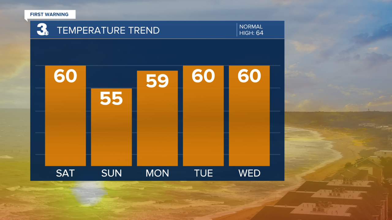
Sunday will be sunnier across Hampton Roads, but also a bit cooler. We expect to top out only in the mid 50s.
An area of low pressure moving up the coast will bring more clouds in eastern North Carolina. And we could even see a few light showers south of the state line.

Sunshine returns in a big way for the work week. And that will help warm things up. By Thursday and Friday we'll climb into the upper 60s and lower 70s.
