


Meteorologist Myles Henderson’s First Warning Forecast
Highs in the 80s and 90s this week. Tracking another rain chance on Thursday.
Highs will return to near 90 today but the humidity will be lower, making today one of our most comfortable days of the week. Expect mostly sunny skies this morning with some clouds building in this afternoon to evening.

Hot and humid again on Wednesday. Highs will reach the mid 90s with an afternoon heat index to 100+. Showers and storms will return on Thursday as a cold front moves through the region.
Highs will bounce between the 80s and 90s to end the week. Expect mid 80s on Friday, warming to the low 90s on Saturday and the mid 90s on Sunday. Afternoon heat index values will be pushed to the triple digits again this weekend.
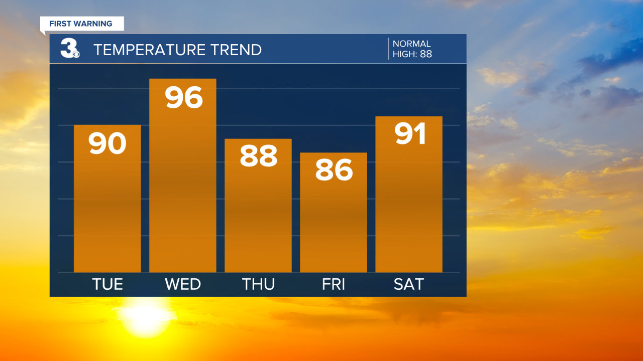
Today: A Few Clouds. Highs near 90. Winds: NE/SE5-15
Tonight: A Few Clouds. Lows near 70. Winds: S 5-15
Tomorrow: Partly Cloudy. Highs in the mid 90s. Winds: S 5-15
Tropical Update
No tropical activity at this time
Weather & Health
Pollen: Low-Mod (Grasses)
UV Index: 10 (Extreme)
Air Quality: Good (Code Green)
Mosquitoes: Extreme
Weather updates on social media:
Facebook: MylesHendersonWTKR
Instagram: @MylesHendersonWTKR
X (Twitter): @MHendersonWTKR
