


Meteorologist Kristy Steward's First Warning Forecast
Happy Thursday evening! We had a great day today with temperatures in the mid 80s, but some changes are coming soon as we head into an unsettled weather pattern for the weekend.
A backdoor cold front heads our way tonight and slowly passes through during the day Friday. A backdoor cold front is one that moves in the opposite direction as most. Most cold fronts travel west to east. This one is moving northeast to southwest.

Around the front, we’ll have some cloud cover, but should be able to stay mostly dry Friday. Temperatures will have a large gradient. Highs ranging from the 60s along the Eastern Shore to the mid 70s along the immediate coastline and the upper 80s inland.

Temperatures look more uniform Saturday. Cooler highs in the low 70s. It will also be a mostly cloudy day, but decently dry. A few spotty showers are possible, but a lot of the rain holds off until later in the day Sunday. Sunday will also be warmer with highs in the upper 70s.
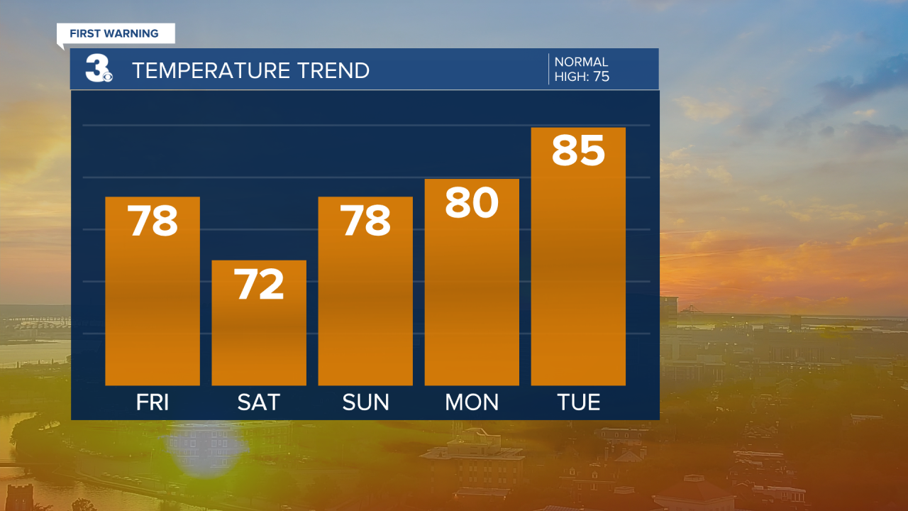
Temperatures keep climbing as the week goes on. Highs reach the mid 80s by Tuesday and flirt with 90° the second half of the workweek. There’s isolated to scattered shower and thunderstorm chances Monday, Tuesday, and Thursday.

Connect with Meteorologist Kristy Steward:
FACEBOOK
X
INSTAGRAM
