

Forecaster Derrah Getter's First Warning Forecast
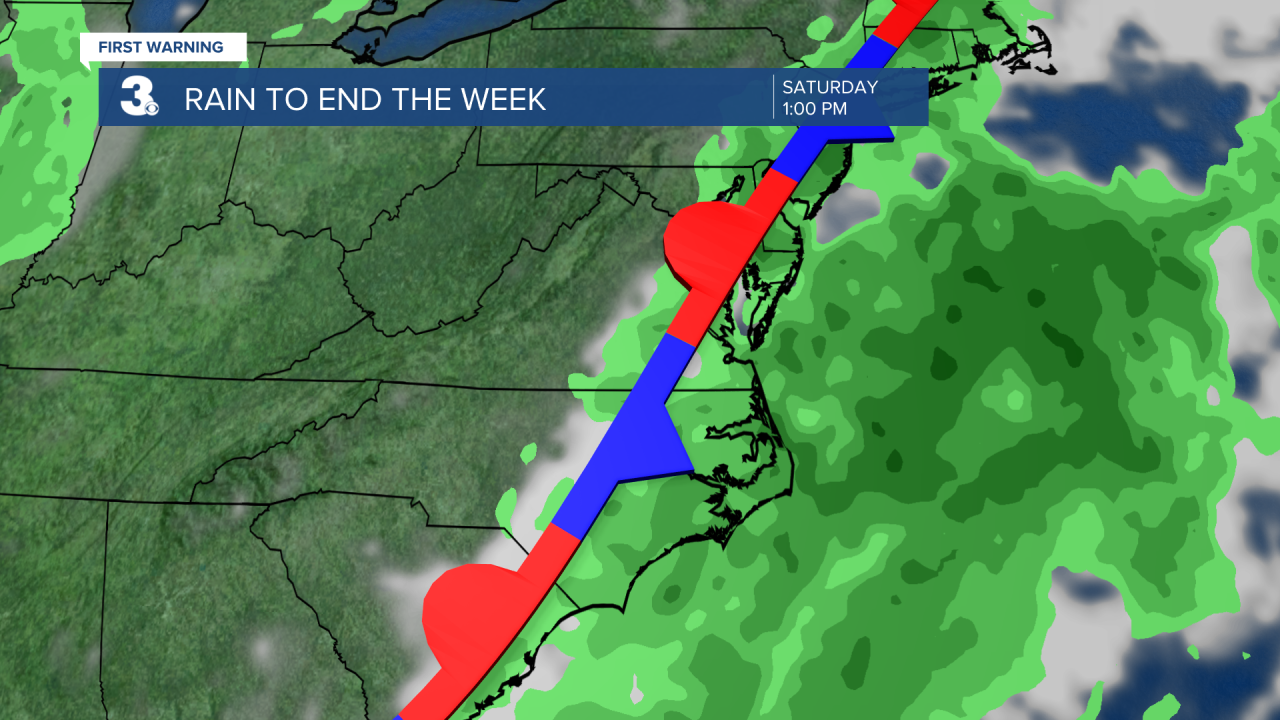
Multiple rounds of heavy rain will be possible throughout Friday. Flooding will be a concern as the storms will be fairly slow moving. Ponding on the roads will be possible with some localized areas seeing 4-5 inches of rainfall.
Highs will be in the mid 80s over the next several days underneath a considerable amount of cloud cover as showers and thunderstorms roll through. There is a level 1 out of 4 threat for flash flooding Friday. All of the rain is courtesy of a cold front that will stall out over the area.
We start to dry out Sunday. Highs will return to the 90s. With all of the lingering moisture, feels like temperatures will hold in the triple digits through the upcoming work week with high temperatures in the mid and upper 90s. Early next week heat index values are expected to reach near 110 degrees.

Tropical Update
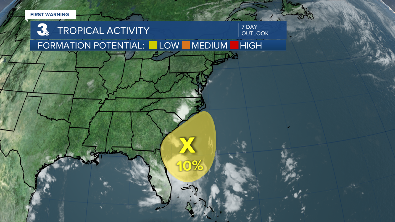
7/11/24 at 7 pm
A broad area of low pressure located a few hundred miles off the southeastern U.S. coast continues to produce disorganized showers and thunderstorms. Regardless of development, heavy rainfall will be possible for parts of the Carolina coast late this week and into the weekend.
Let's connect on social media!
Forecaster Derrah Getter:
For weather updates on Facebook: HERE
For weather updates on Twitter: HERE
Follow me on Instagram: HERE
Check out the Interactive Radar on WTKR.com: Interactive Radar
