


Derrah Getter's First Warning Forecast
Isolated showers and storms possible the rest of the evening. Otherwise, mild with the exception of the humidity.
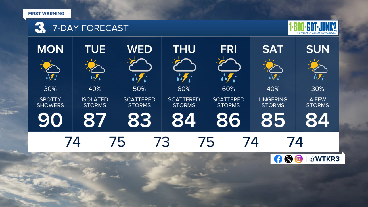
A few lingering showers possible in the morning with considerable cloudiness. Spotty storms will be possible in the afternoon. Highs will be near 90 but after factoring in the humidity it will feel close to 100 degrees.
Temperatures throughout the week will tend to be around the mid 80s. Despite the less hot temperatures humidity will stick around so it will still feel steamy outside. Rain chances will be highest through the middle of the week as tropical moisture from Debby approaches.
Tropical Update
As of 08/04/24 at 5 pm
Tropical Storm Debby is bringing torrential downpours to parts of Florida. There have been no significant changes in pressure. The western flank has limited deep moisture, but the center is trying to strengthen. It is forecast to become a category 1 hurricane by tonight as it continues moving over the warmer Gulf waters. It could potentially stall out over land and weaken or briefly move over the Atlantic and strengthen. Either way, extreme amounts of rainfall is expected for Georgia and South Carolina.

A tropical wave a few hundred miles east of the Winward Islands is producing showers and thunderstorms. Gradual development is possible over the next week.
- Formation chance through 48 hours...LOW (10%)
- Formation chance through 7 days...LOW (20%)

Let's connect on social media!
Forecaster Derrah Getter:
For weather updates on Facebook: HERE
For weather updates on Twitter: HERE
Follow me on Instagram: HERE
Check out the Interactive Radar on WTKR.com: Interactive Radar
