


Forecaster Derrah Getter's First Warning Forecast
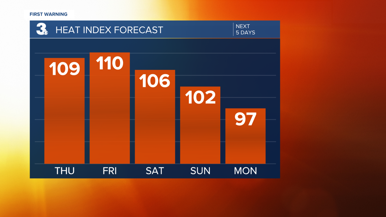
Highs Thursday will climb to the mid 90s but it will feel even hotter. Heat index values will be around 110 degrees. With dew points in the middle 70s, it's definitely steamy but the moisture levels aren't high enough to elicit widespread rainfall just yet. Widespread rainfall won't reach us until the weekend.
Despite the skimpy coverage in rainfall on Thursday, those of us that do see the storms will be at risk for damaging wind gusts, localized flooding and possibly hail. The entire area is under a level 1 out of 5 severe weather threat both Thursday and Friday.

The intense heat holds on through at least Saturday. Even though temperatures won't be as hot at the beginning of the upcoming work-week, it will still feel like it's near 100 degrees Monday.

Let's connect on social media!
For weather updates on Facebook: HERE
For weather updates on Twitter: HERE
Follow me on Instagram: HERE
Check out the Interactive Radar on WTKR.com: Interactive Radar
