

Forecaster Derrah Getter's First Warning Forecast
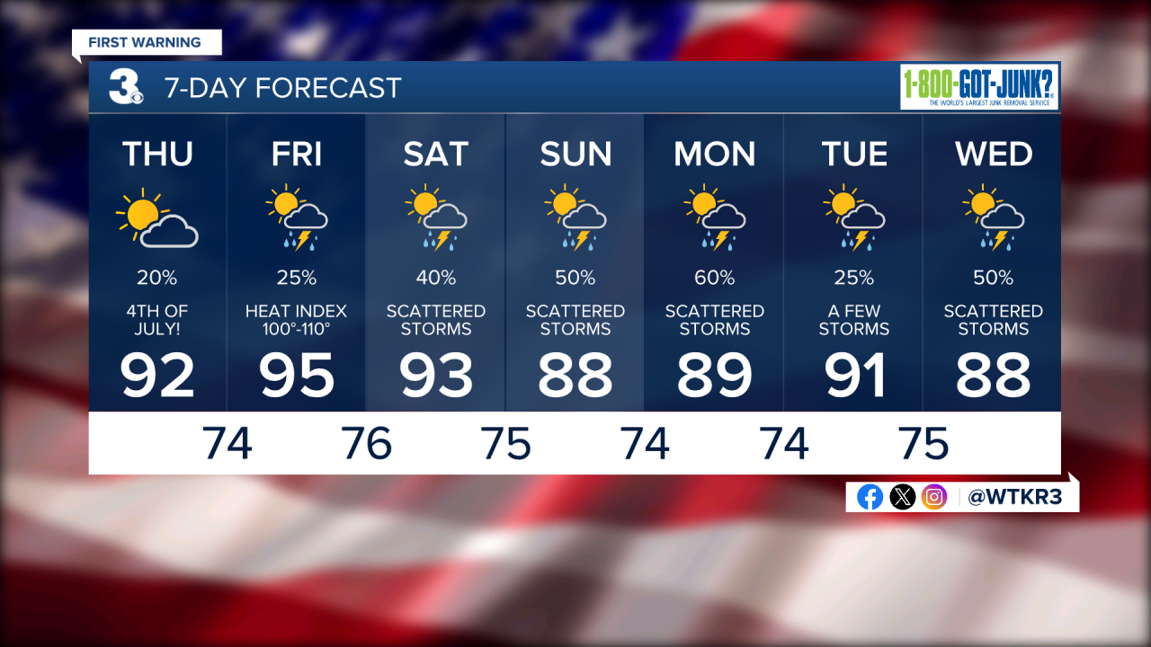
A few clouds but mainly sunshine throughout the day Thursday. The afternoon will be warm with highs in the low 90s. The humidity will be higher which will cause it to feel like the upper 90s, near 100 degrees. There will be the chance for an isolated shower or thunderstorm during the evening.

Friday will be our steamiest day of the week. Highs will climb to the mid 90s with feels like temperatures soaring to near 110 degrees. Rain chances stay elevated but remain fairly low.

A cold front appraches Sunday bringing the chance for showers and thunderstorms. Temperatures during the beginning of the upcoming work week fall to the upper 80s and low 90s.
Tropical Update
As of 7/3/24 at 5 pm
Hurricane Beryl is expected to head for the Cayman Islands after bringing dangerous conditions to Jamaica. It is expected to weaken to a category 2 before reaching the Yucatan Peninsula.

A tropical wave near the Winward Islands is producing disorganized showers and thunderstorms. Development will be fairly slow as it moves west northwestward at 15-20 miles per hour.

Let's connect on social media!
Forecaster Derrah Getter:
For weather updates on Facebook: HERE
For weather updates on Twitter: HERE
Follow me on Instagram: HERE
Check out the Interactive Radar on WTKR.com: Interactive Radar
