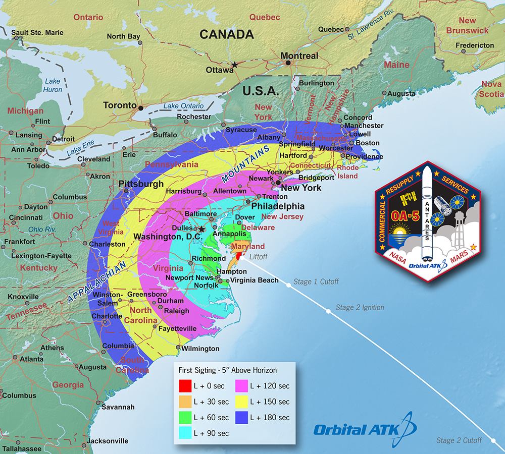
CHINCOTEAGUE ISLAND, Va. – Orbital ATK has created a visibility map that shows areas that should be able to see launch of an Antares rocket on Monday.
The rocket is carrying Orbital ATK’s Cygnus spacecraft on a resupply mission to the International Space Station from NASA’s Wallops Flight Facility on the Eastern Shore.
The launch was rescheduled for Monday at 7:45 p.m. due to a faulty ground support equipment cable.
“Ability to see the launch may be possible throughout the Mid-Atlantic, depending on location, elevation and local weather conditions,” NASA Wallops Flight Facility said on their Facebook page.
The launch was the first to the ISS from Wallops Island since October 2014, when an Antares rocket exploded just six seconds after launching from Launch Pad – 0A at Wallops.
The Cygnus spacecraft will carry approximately 5,290 pounds of supplies and science experiments to the ISS under the Commercial Resupply Services contract with NASA.
RELATED:
Antares rocket launch from Wallops scheduled for Monday night
Antares rocket launch from Wallops delayed until September
Orbital conducts full-power test of Antares rocket propulsion system at Wallops
New Antares rocket rolls out for testing at NASA Wallops
Repaired launch pad ready for testing at Wallops Island
NASA shares new photos of Antares rocket explosion during Wallops Island launch
